• Stacks Image 3
  • Stacks Image 6
  • Stacks Image 9
  • Stacks Image 12

Wye Invader - The Impossible Journey?

Fit My Video Tag

The Story

Stacks Image 142
First built in Holland in 1930, the Wye Invader was originally named “Luctor”. There is some evidence (although sadly undocumented) she had an extra section fitted and was seconded by the German Army to become part of ‘Operation Sea Lion’, the German plan to invade Britain by sea that was scrapped in 1940.

In 1970 she was owned by the Hooiveld family who re-named her “Zwerver” and the family lived on board for several years. The Barge had several more owners in the years that followed and was finally bought as “Zilvermeeuw” by Frank Barton, a garage owner from Hereford who re-named her “Wye Invader” and who had plans to turn her into a floating restaurant moored in Hereford, UK. Planning Permission was later granted for this.

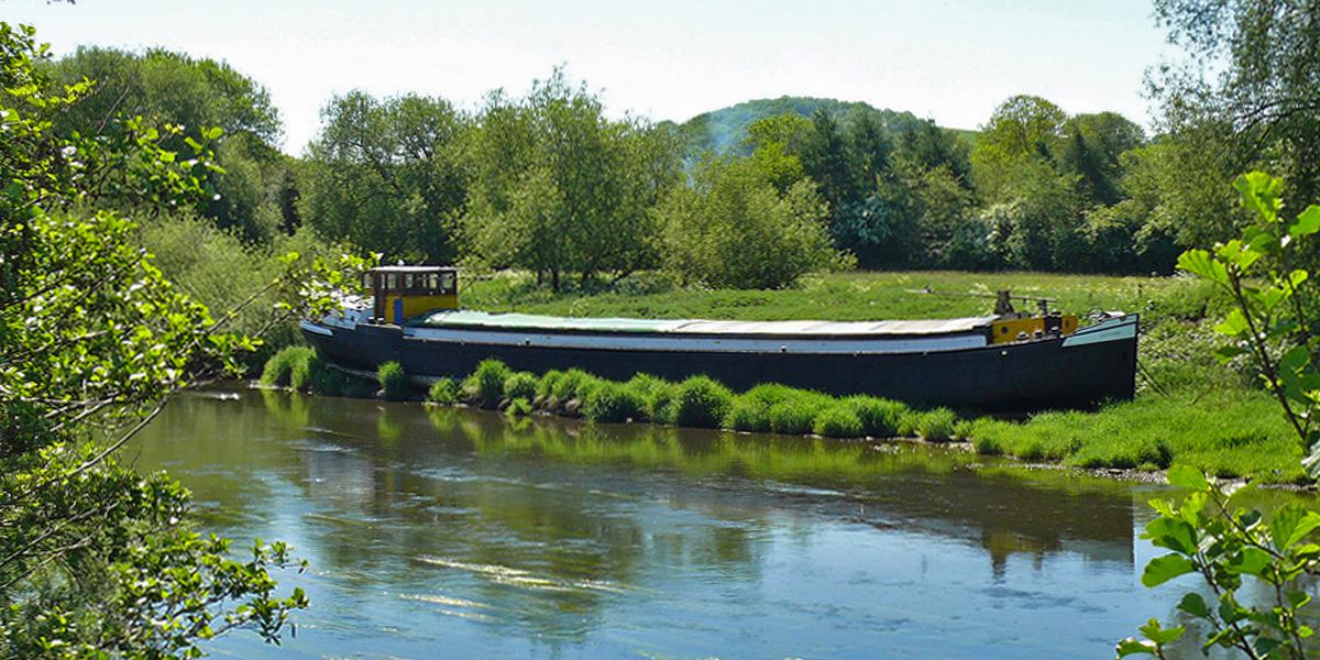
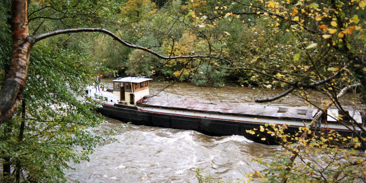
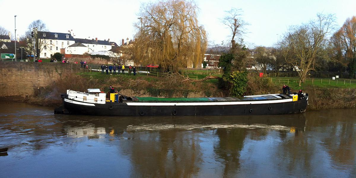
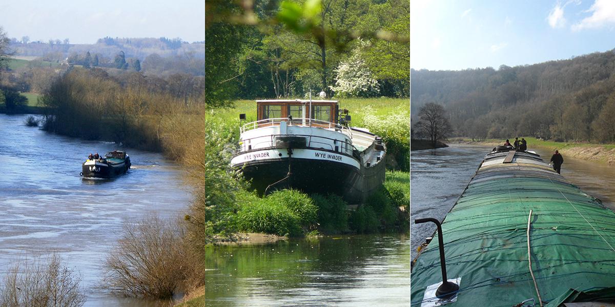
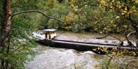
The Barge crossed the Channel, rounded the South Coast and turned into the River Severn Estuary. At Chepstow she joined the River Wye, navigating several tight, well known bridges and then the famous Symonds Yat Rapids. The journey to Hereford of 75 miles was to take longer than planned due to low river levels that summer and she reached her final mooring just above the Old Wye Bridge, Hereford on the 11th November 1989, the actual journey time was 20 hours spread over the 6 month period. The magazine Waterways World published 2 articles about the Wye Invader you can read here.

An important personal opinion on dredging the Gloucester & Sharpness Canal.

The Sharpness Canal: Dredging and the Consequences of Not Doing It

Between November 2012 and March 2013, I returned the Wye Invader, a 38-metre Dutch barge, from Hereford down the River Wye to Sharpness Dry Dock. Later that summer, Andy and I navigated the same 38-metre vessel up the canal as far as Diglis Lock before returning to Sharpness.

To our knowledge, this was the largest vessel to pass Tewkesbury since the grain barges stopped unloading at the town’s mills, which I believe was around 1977.

Stacks Image 6817

In 2014, I bought a narrowboat. Apart from a short period at Saul Junction, it has been moored at Sharpness Marina ever since. Over the past 12 years we have filmed around 57 short videos and taken thousands of photos along the River Severn and the Gloucester & Sharpness Canal.

Our journeys have taken us downriver to Portishead, Bristol, and Cardiff, and upriver to Stourport. We have also travelled the Sharpness Canal itself many times. One recent trip was on a frosty Saturday morning to Saul Junction, covered in ice just before first light, waiting for Purton to open at 08:00.

We have also completed two trips from Sharpness up the Severn via the Lower Parting to Gloucester Lock, and via Maisemore down the Parting to the same lock.

Given all this, it’s fair to say we’ve documented the canal in considerable detail and in all seasons over the past decade.

Stacks Image 6822

Changes in Water Depth
About two years ago we noticed something unusual: the canal water depth had increased.

Previously there was always a two-to-three-foot gap between the water level and the top of the steel piling that lines the canal banks from Gloucester to Sharpness. These piles form a substantial containment barrier. In several places the canal sits higher than the surrounding fields.

When boats passed, their bow waves were normally contained by the exposed piling. But as the water level rose, that protection disappeared. The waves began spilling over the top of the piling onto the towpath. Water also soaked down the outside of the piles, searching for a way to drain away.

This now happens along many of the elevated sections of the canal. Given the recent canal breach, that situation is concerning.

Stacks Image 6827

Dredging
From what I remember, the Canal & River Trust has carried out around five local dredging operations along the canal over the past 12 years. Work has also recently been completed in Gloucester Docks.

Water Management
Bristol Water and the Canal & River Trust work together to manage canal water levels. Both organisations recognise that over half of Bristol Water’s supply comes from the River Severn. The Gloucester & Sharpness Canal acts as a conduit to support this system. Because of this, the canal’s reliability is critical. Any failure would have significant consequences.

Conclusions
In several elevated sections of the canal, the water level now sits close to the top of the steel piling. When boats pass, waves often wash over it. This suggests the canal may already be operating close to its maximum capacity.

Stacks Image 6832
Stacks Image 6852

At a recent meeting in the docks, it was mentioned that 2025 has been a heavy year for silt entering the canal from the River Severn, amounting to thousands of tons. From what I understand, this has been happening since the canal was first built. The presence of a large restored steam dredger outside the museum is a reminder of how important dredging once was.

Summers are likely to become warmer, which will increase demand for Bristol Water. If the canal is already at capacity, continued silt buildup will only add to the pressure.

The only practical way to increase capacity is to dredge the lower third of the canal bed between Gloucester and Sharpness. This would remove the accumulated silt and should then be maintained with regular dredging.

Finally, there is a damaged weir at Maisemore. By summer it could allow hundreds of thousands of gallons of water to bypass Gloucester Dock Lock and the pumping system.

The Gloucester & Sharpness Canal is not just a historic waterway. It is:

* A navigation route
* A flood management structure
* A key part of the regional water supply system

After more than a decade of filming, navigating, and observing the canal in all seasons, one conclusion seems clear - Without regular dredging and careful water level management, pressure on the canal system will continue to grow, and the longer the issue is left unaddressed, the greater the risk becomes.

Stacks Image 6849