
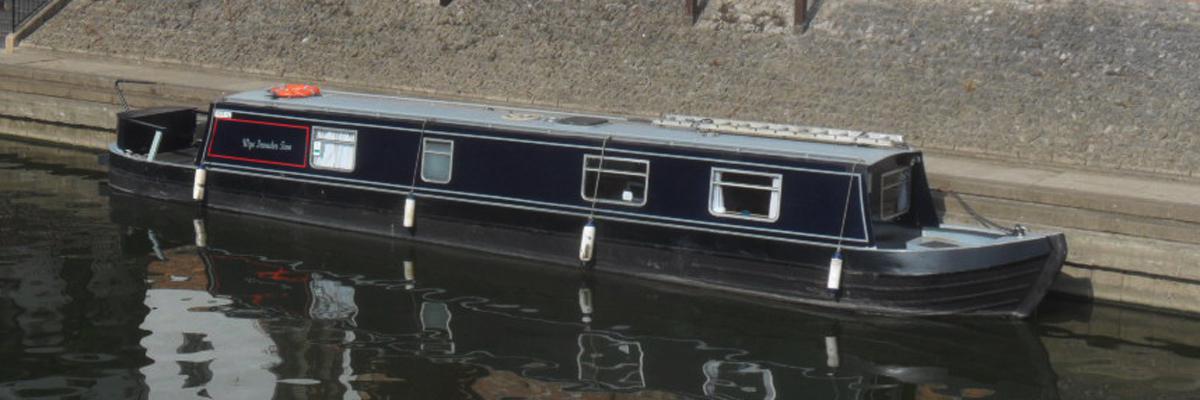
An exercise in navigation
The plan was to give a friend some navigational experience on the tidal River Severn over a 2 day period pointing out the Channel Port (Red) and Starboard (Green) markers and various Transits used to mark and assist passage in the tidal River Severn Estuary.
Day 1 > Sharpness > Chepstow > Brockweir
Day 2 > Brockweir > Chepstow > Portishead > Sharpness
Day 1 > Sharpness > Chepstow > Brockweir
Day 2 > Brockweir > Chepstow > Portishead > Sharpness
Pre-Planning:
Sunday 10th June 1700 Hours. The bridge for access to docks and lock need to be booked 24 hours in advance, they will open a day early as the tide is early morning, we will be moored just outside the lock for the night.
Monday 11th June. We will move into the lock at 0500 hours and lock down at 0510 hours as a workboat is booked out early. High Water is at 0630 hours, We’ll have to move off the pontoon at 0615 hours as the Sea Lock will be closed to save water at 0630hrs.
Weather and tide forecast:
Monday 11th June. The wind is forecast to be NNE 12 knots
am Tide, Spring, 0629 hours - Height 7.4 metres.
pm Tide, Spring, 1901 hours - Evening Height 8.1 metres
Tuesday 12th June. The Wind is forecast to be North by East 15 knots
am Tide, Spring, 0727 hours - Height 8.51 metres
pm Tide, Spring, 1953 hours - Height 8.9 metres
The trip:
Monday 11th 0430 hours. Martyn came on board, a workboat Riparian moved into the lock and we started our engine and moved into moor alongside. 0500 hours - after being lowered to sea level we moved astern to allow the other boats to leave, we then moored alongside the pontoon until 0615 hours. I made a radio check to Sharpness and asked permission to leave at 0615 hours, Sharpness returned the call and confirmed the request. In the meantime, Andy put the kettle on and we talked about what we were about to do. At this time, just before departing the lock, it’s important to have an understanding as to the depth of the tide because most of the River Severn above the Old Severn Bridge drys out at low water, I pointed out to Martyn the lock exit just forward of the gate on the port side where there was a depth gauge in metres showing 7 metres.
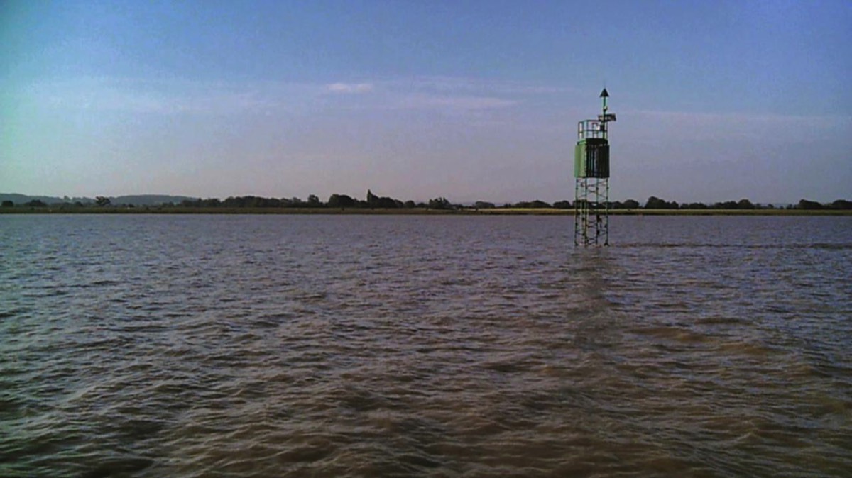
0615 hours. We departed the pontoon, as we passed the downstream entrance to the outer Sea Lock the tide is still rising, the tidal water can still be seen passing the end of the Pier. About 1 mile ahead, the Old Berkeley power station can be seen on the left bank, looking downstream on the bank just forward of the power station by Berkeley Pill, 2 towers can be seen, the smallest near to us and the larger to the rear, with the power station in the background. We lined the towers up and follow them, this is the first Transit we follow (Leading lights 187 deg 46 min), there are several more to aid navigation on the Severn and Sharpness down to Avonmouth.
0804 hours. Wye Invader Two is about 200 metres below the Old Severn Bridge with Chapel Rock on the starboard side, we turned to starboard and crossed the 5 to 7 metre Sand Bar below the part of the Bridge that crosses the River Wye just above the confluence of the Wye and Severn.
0846 hrs. As we passed under Chepstow Town Road and then the Rail Bridge on the port side, the floating pontoon in the front of the Boat Inn is still afloat. We always moor against this for about 30 to 60 minutes until the ebbing tide has lost some of its power and then move out onto a mooring out in the river.
1540 hours. The tide was well on it’s way back in and the water level was just below the pontoon so it was time to leave and go on up the River Wye to Brockweir, High Water was at 1900hrs.
1553 hours. We were now about a mile on from Chepstow Castle, high limestone cliffs on our Starboard and trees on the port side.
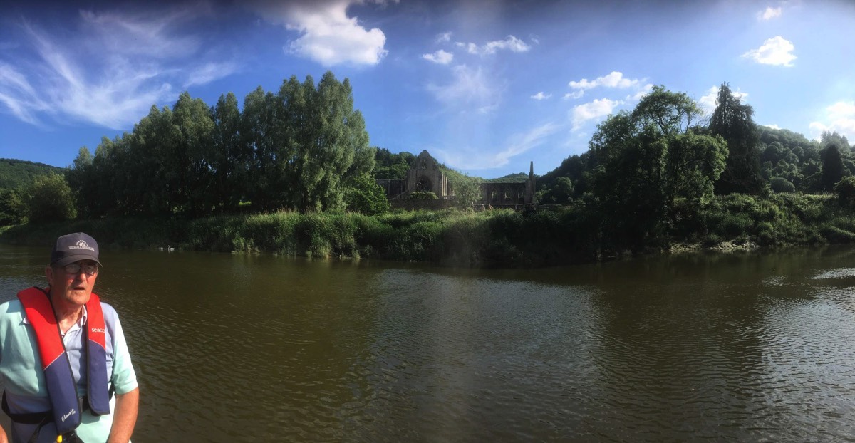
1745 hours. Tintern came into view, the tide was held back by the weir on the upstream side of the Old Rail Bridge, now a footbridge and with some access for cars. The tide was held back for about 15 minutes and then it started to move as it overcame the Weir and the river started to move again. We floated by Tintern at about 2 knots and then onto Brockweir, a mile further up river.
1553 hours. We were now about a mile on from Chepstow Castle, high limestone cliffs on our Starboard and trees on the port side.
1745 hours. Tintern came into view, the tide was held back by the weir on the upstream side of the Old Rail Bridge, now a footbridge and with some access for cars. The tide was held back for about 15 minutes and then it started to move as it overcame the Weir and the river started to move again. We floated by Tintern at about 2 knots and then onto Brockweir, a mile further up river.
1815 hours. Brockweir came into view, the tide was halfway up the quay, I turned Wye Invader Two as soon as we passed it and then came about into the oncoming tide to moor up. As soon as we secured we found we had a problem, the grass and mud which had been cleared off the quay and pushed into the river, leaving a mud bank half the length of the quay and about 1 metre out into the river, this was fine for canoes but we had no other mooring and this has stopped anyone with a boat using the quay. We had no choice but to moor with the stern moored out away from the Quay, held by a spring line and with the bow secured from moving forward, in turn stopping Wye Invader Two closing onto the Quay and slipping sideways into deeper water off the mud bank as the tide ebbed.
Tuesday 0545hrs. The river passing over the remains of what is left of Brockweir form a small rapid under Brockweir Bridge, when the tide comes in the noise disappears and so do the rapids, Wye Invader Two was soon afloat and we cast off into the oncoming Spring Tide.
0612 hours. We were about 200 metres below Brockweir Bridge and making 3.4 knots against the oncoming Spring Tide, Tintern soon comes into view on the starboard side. 0739 hours - about half a mile ahead Chepstow castle can be seen on top of its limestone cliff.
0612 hours. We were about 200 metres below Brockweir Bridge and making 3.4 knots against the oncoming Spring Tide, Tintern soon comes into view on the starboard side. 0739 hours - about half a mile ahead Chepstow castle can be seen on top of its limestone cliff.
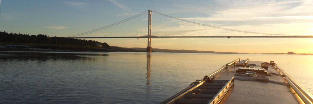
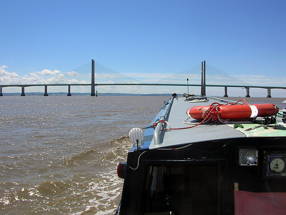
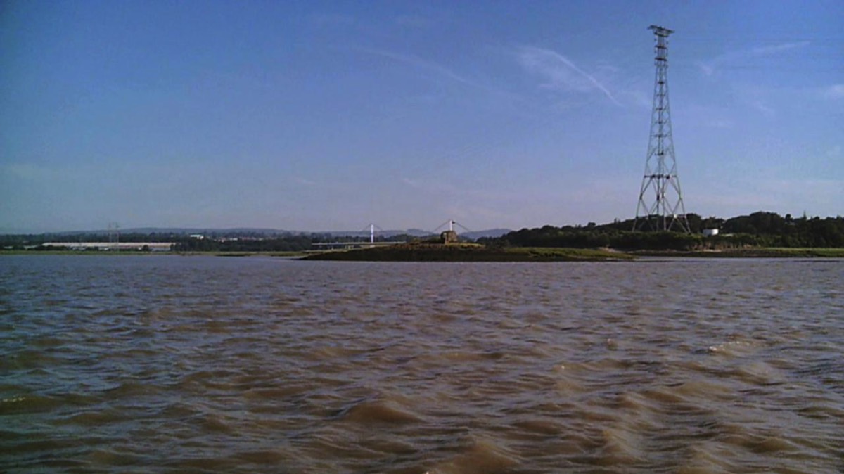
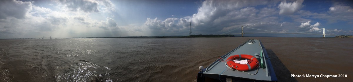
0754 hrs. Wye Invader Two passed under Chepstow Bridge and was travelling at 7.8 knots, 0805 hours - We passed under the River Wye part of the Old Severn Bridge and a few minutes later we were on the River Severn heading towards the New Severn Bridge.
0820 hours. We left the New Severn Bridge astern and were travelling at 10 knots towards Avonmouth and then on down to Portishead following the Starboard Channel markers. 0845 hours - Portishead confirms that they have a lock up into their Marina at 0915 hours.
0905 hours. We entered the lock and at 0915 we lock up. Wye Invader Two had been booked into Portishead a few days earlier and we were booked to leave on the first tide this afternoon lock out at 1530 hours. We now had from 0930 hours until 1515 hours to have a walk around the Marina and have a coffee or two.
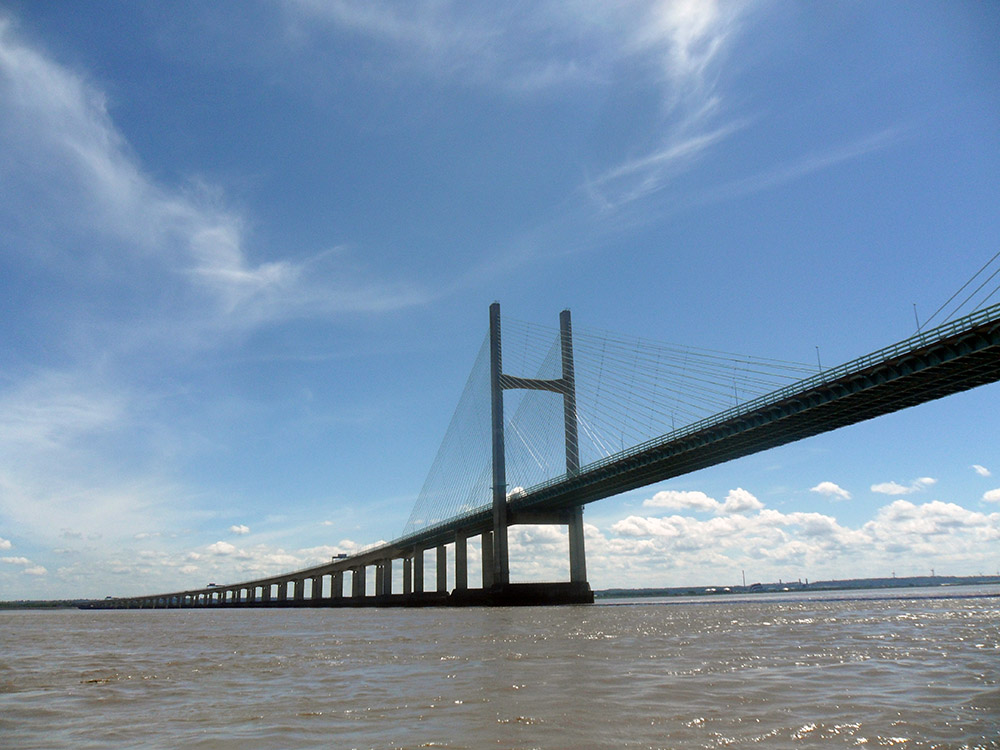
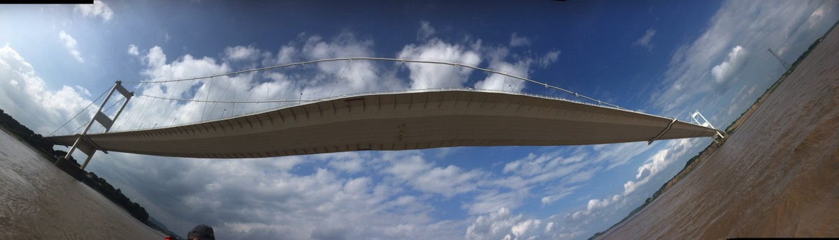
1535 hours. We departed Portishead Pier and moved out of the shelter of the Pier, the tide can be felt pushing Wye Invader Two sideways, by the time we were half a mile out from the shore we were moving at 10 knots, we passed under the New Severn Bridge and are just short of the Old Severn Bridge, it was now 1620 hours.
1700 hours. Wye Invader Two passed under the Old Severn Bridge and turned to Port, we passed the port channel marker on Lyde Rock just upstream of the Bridge Pier. On the starboard side, the tide is being pushed up and onto Slime Road sandbanks. We turned to starboard onto Slime Road (Transit ) from the stern as far as Inward Rocks, then turned to starboard across the River Severn.
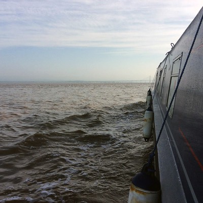
We passed Counts and Narlwood Rocks on the starboard side, turned to port onto Narlwood Transit and then various starboard channel markers, as we passed Hills Flats and on toward Hayward Rocks, the River Severn became rough, the waves were standing about a metre high with some breaking over the bows, with a Spring Tide at almost 9 knots and a North East wind, all added up to an interesting Wind over Tide situation.
We were called by VHF Sharpness and asked to move out of the channel to starboard to allow a ship to leave and pass down to Avonmouth, as we were making good speed that was changed, they would wait for Wye Invader Two to enter Sharpness instead, so we obliged and at1815 hours we entered Sharpness, a little windswept and the end of an interesting 2 days (36 hours) on the River Severn and River Wye, although I think Martyn and Andy might have had different thoughts on that!
1700 hours. Wye Invader Two passed under the Old Severn Bridge and turned to Port, we passed the port channel marker on Lyde Rock just upstream of the Bridge Pier. On the starboard side, the tide is being pushed up and onto Slime Road sandbanks. We turned to starboard onto Slime Road (Transit ) from the stern as far as Inward Rocks, then turned to starboard across the River Severn.
We passed Counts and Narlwood Rocks on the starboard side, turned to port onto Narlwood Transit and then various starboard channel markers, as we passed Hills Flats and on toward Hayward Rocks, the River Severn became rough, the waves were standing about a metre high with some breaking over the bows, with a Spring Tide at almost 9 knots and a North East wind, all added up to an interesting Wind over Tide situation.
We were called by VHF Sharpness and asked to move out of the channel to starboard to allow a ship to leave and pass down to Avonmouth, as we were making good speed that was changed, they would wait for Wye Invader Two to enter Sharpness instead, so we obliged and at1815 hours we entered Sharpness, a little windswept and the end of an interesting 2 days (36 hours) on the River Severn and River Wye, although I think Martyn and Andy might have had different thoughts on that!
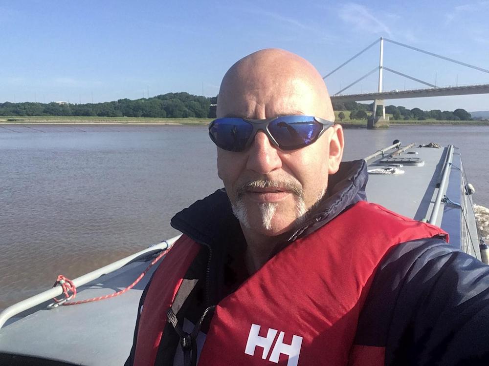
With thanks to Martyn Chapman for some of the photos.